The Conrad Blucher Institute at Corpus Christi is using drones and geographic information science (GIS) to revolutionize geospatial-aided decision making for pressing problems in coastal resiliency, sustainable resource development, and crop management.
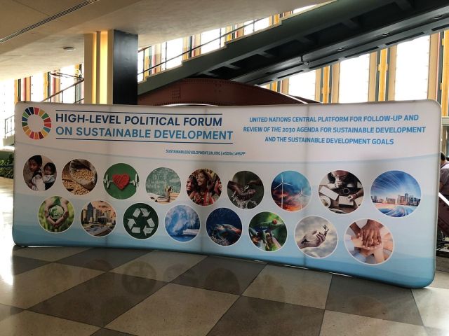
Last year, Texas A&M University-Corpus Christi was one of three universities, including Harvard and the University of Maine, to join an academic network that is creating create solutions for 17 sustainable goals using geographic information systems (GIS) by 2030.
Future goals include acquiring grants to attract incoming graduate and doctoral students to develop new GIS programs to help solve the world’s issues while working on their dissertation
“A couple of years ago, the United Nations came up with 17 sustainable development goals such as no poverty, quality education, and gender equality,” explained Dr. Gary Jeffress, professor of geographic information science and director of the Conrad Blucher Institute for Surveying and Science at Texas A&M Corpus Christi. “They are all noble goals, many of which affect us right here in the Coastal Bend.”
For example, not everyone in South Texas has access to clean water and sanitation, affordable energy, or access to education, Jeffress added.
To help find resolutions, Jeffress, along with Dr. Michael Starek, associate professor of geospatial systems engineering and the director of the Measurement Analytics Lab, attended a forum hosted by the United Nations Committee of Experts on Global Geospatial Information Management Academic Network from July 30 to Aug. 3.
The international partnership aims to merge every country’s census data with mapping technology in a GIS environment.
With this map, international experts and experts from CBI can pinpoint precise areas in need of economic, social, and environmental aid.
“We’re collecting data for a purpose,” said Jeffress. “We can take existing knowledge, like census data, and apply it in a practical sense to impact the lives of many. It’s an opportunity to expand projects we’ve done locally, such as locating medically underserved areas or identifying crop diseases, on a global scale.”
Additionally, Dr. Lucy Huang, associate professor of geographic information science, uses GIS techniques to analyze health issues, such as health care access, that can be used to meet the United Nations’ goal of “good health and well-being” for all.

The U.S. Army Corps of Engineers has been tasked with…
Brown and Caldwell, a leading environmental engineering and construction firm,…
Humboldt State University, one of four campuses within the California…